Traunstein 23.8.2009
My son Peter is staying in Salzburg and has a few days off
before his South America - tour with the
Camerata Salzburg. So
we meet (not exactly) in the middle- For years, I fancied to climb Traunstein,
because it is standing alone near the lake Traunsee and
the town of Gmunden and can be seen from afar. If you drive the highway from
Salzburg to Vienna or take the train, you can see it if there is clear weather.
I even saw it from the aeroplane on a fligh to Zurich. With its height of 1.691 m
it is not the highest one around, but it there is a height difference of 1.268 m
from the very close Traunsee (423 m)
to the summit. Two good Alpine huts are situated on its plateau, to which are
leading several ferratas. However, we chose the "normal ascent" from Mairalm, by
many taken as a descent route.
We have a late start at 10 a.m. because the weather forecast is for improvement
in the afternoon. So we start with bicycles from Gmunden, because you must
expect the small parking ground at the Moaristidl inn to be occupied, and we
want to avoid a walk of some kilometres along the lake.
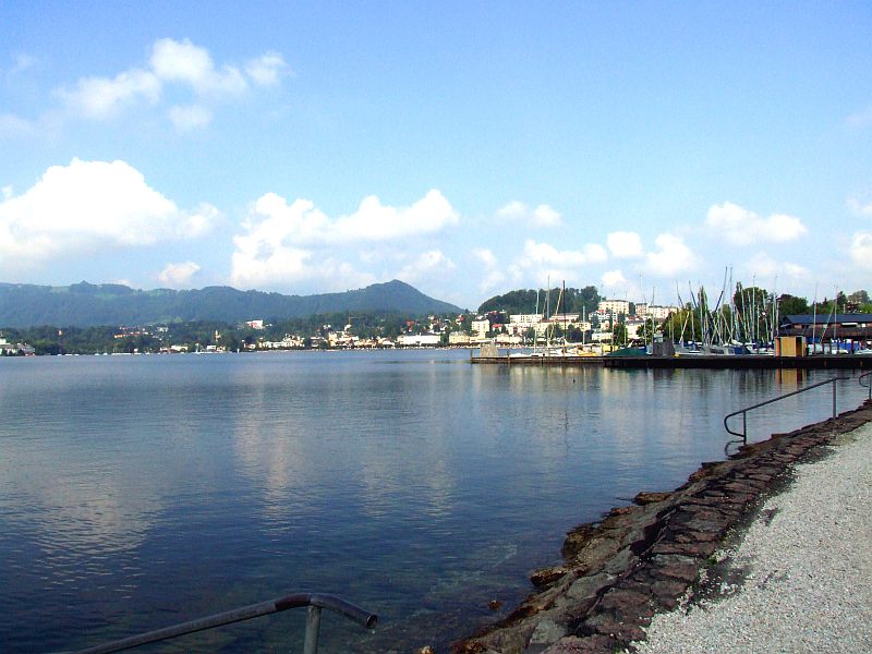
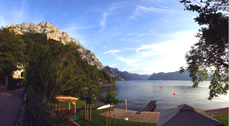
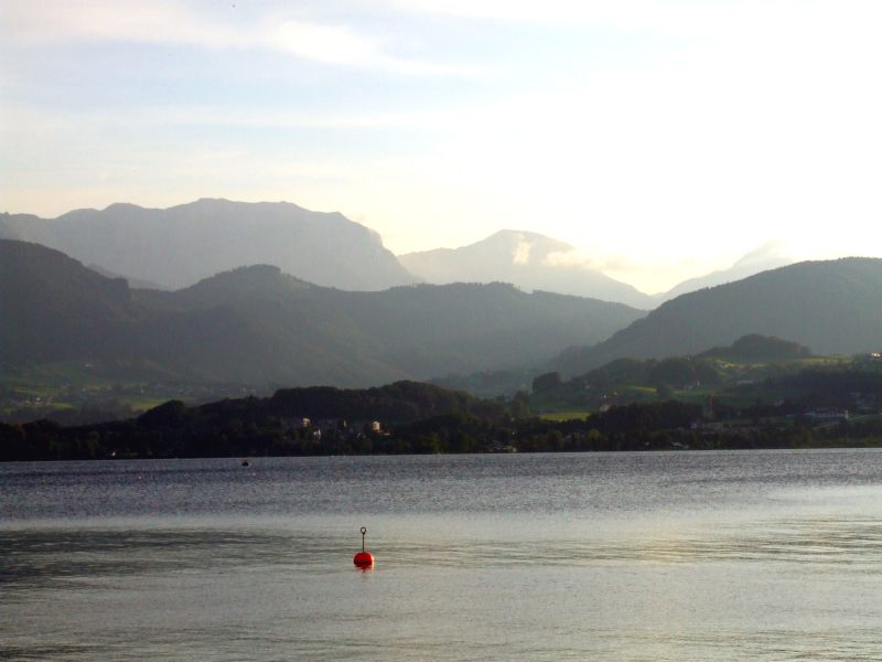
View on Gmunden - the weather isn´t bad, after yesterday´s heavy rain.
Gmunden on lake Traun (Traunsee).
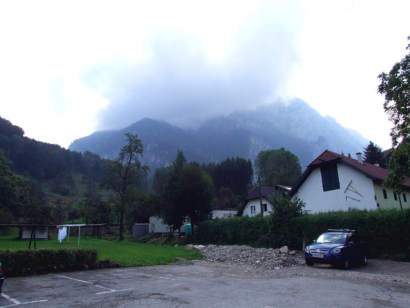
Traunstein still wrapped in clouds though.
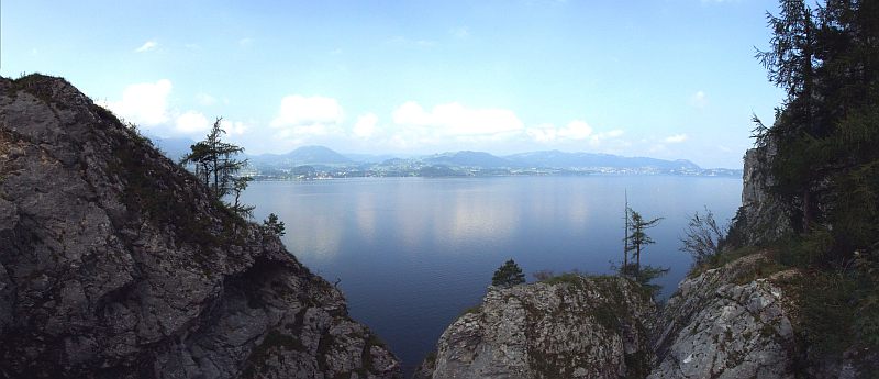
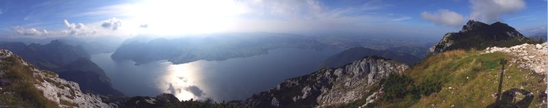
Panoramic view from the bridge over the Lainau beck to Traunsee. Click here or into the picture for a larger version.
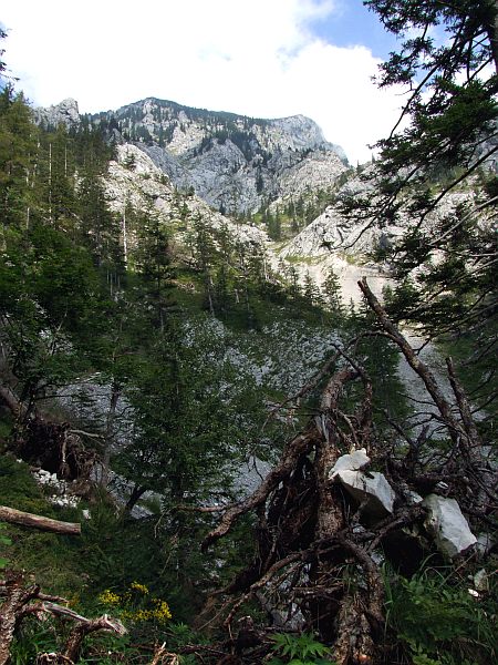
After a boring walk along the gravel road of the Lainau beck - valley we enter the narrow path winding up the extremely steep southern slopes of Traunstein.
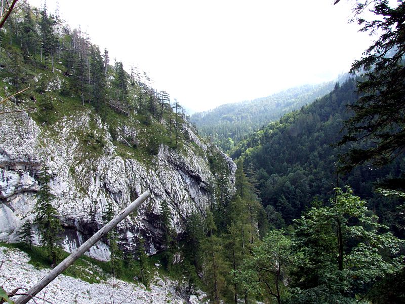
Many escarpments to be circumvented by the path.
The view opens more and more ...
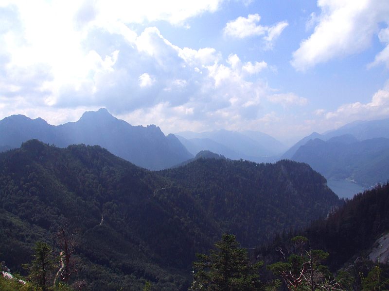
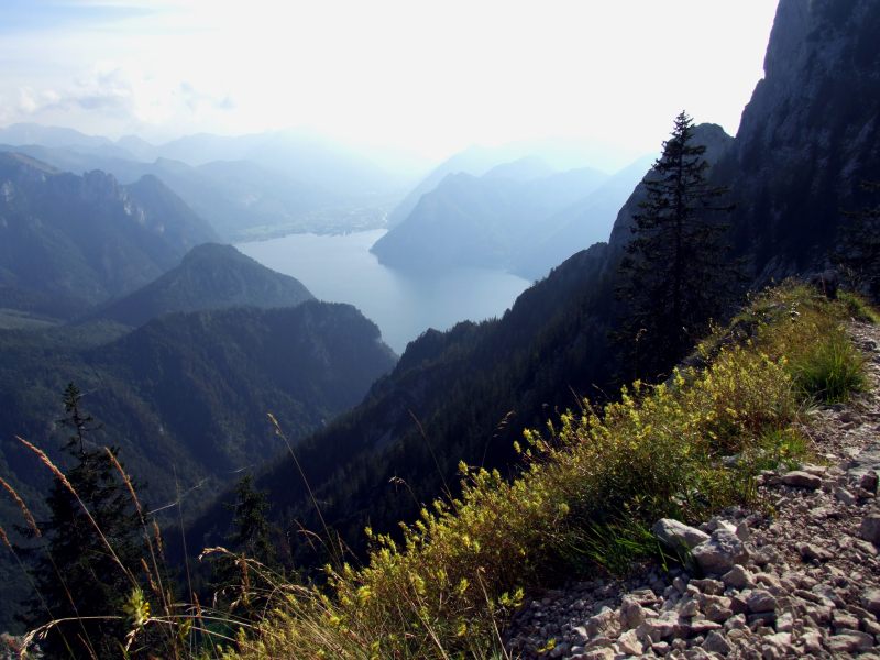
... to south - the head of the lake Traunsee with the village of Ebensee.
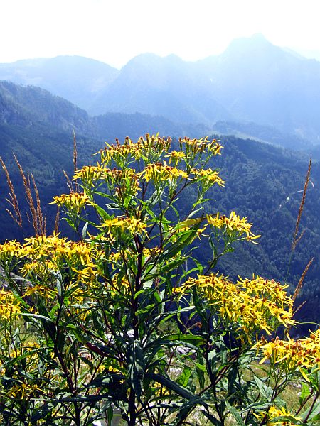
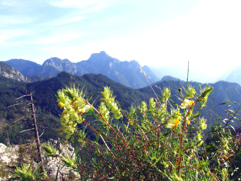
Fuchs - Kreuzkraut (Senecio ovatus)
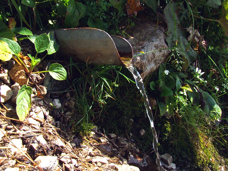
Small fountain near the path - they say it´s the only one on the whole Traunstein massive.
Walking higher now.
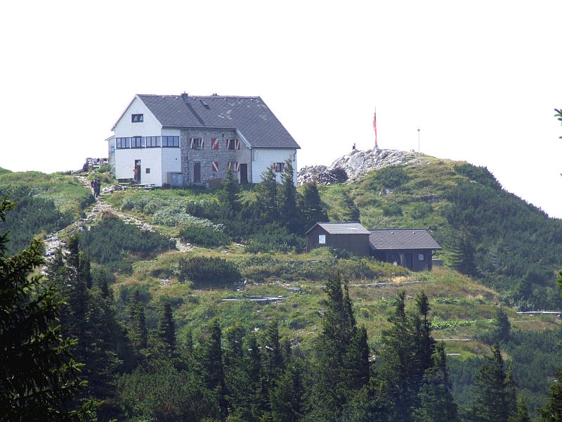
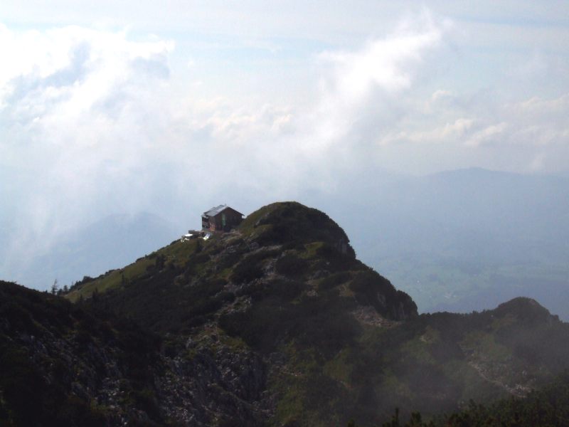
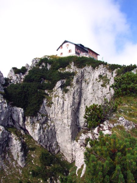
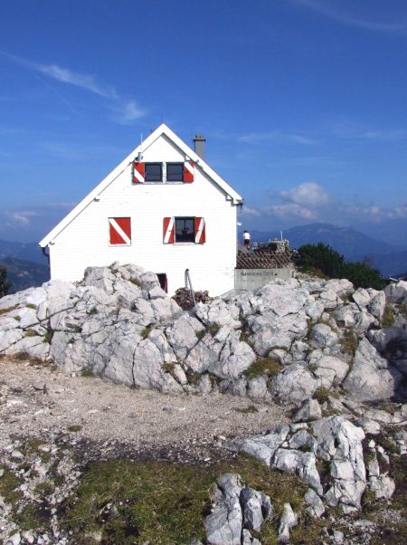
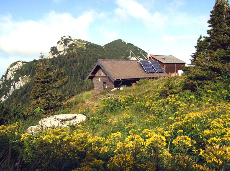
Arrived on the plateau: Traunsteinhaus - here one of the ferratas is ending.
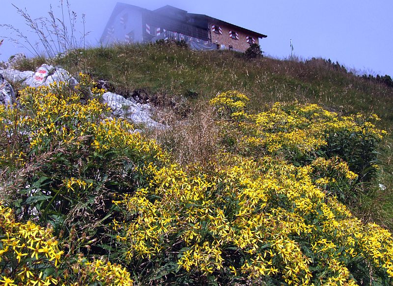
Fuchs - Kreuzkraut on the slope to the second lodge, Gmundnerhuette. Here we have a long lunch break.
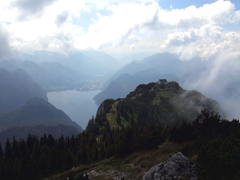
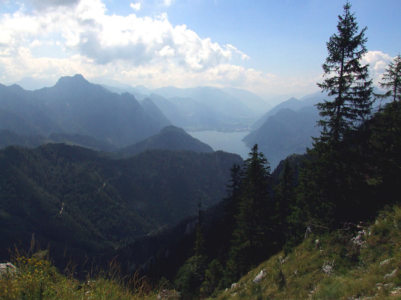
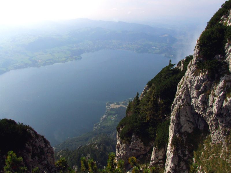
Traunsteinhuette and the view to the head of Traunsee with Ebensee.
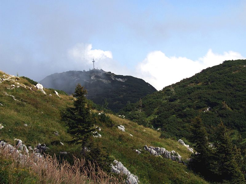
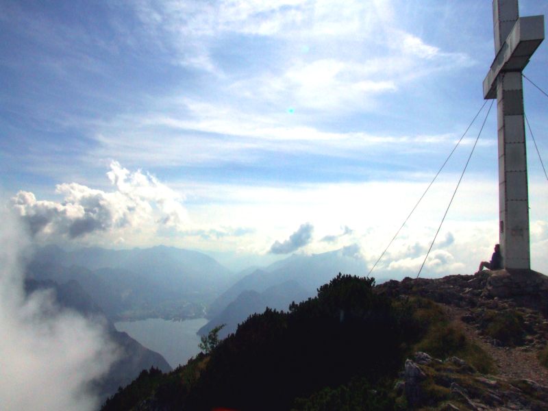
The summit cross of Traunstein
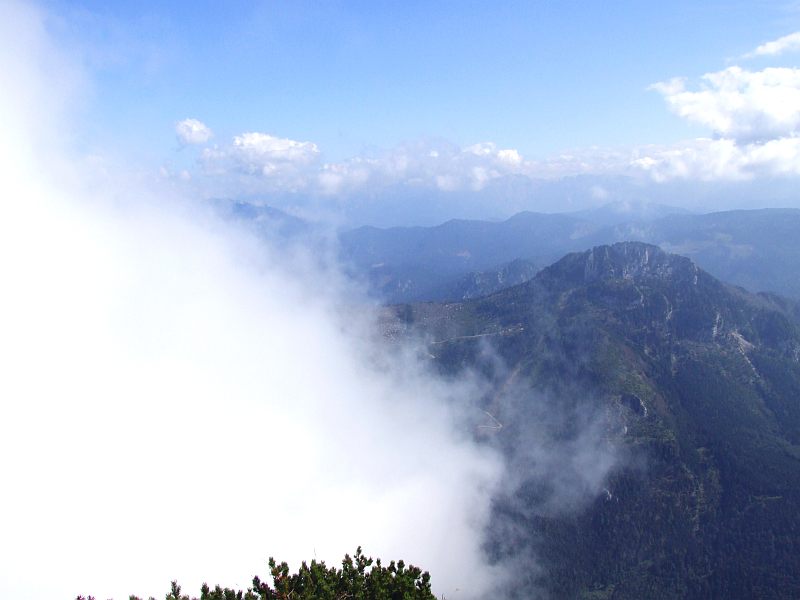
We have reached an altitude where mist is moving around us, which we are observing when sitting and eating on the outside terrace of the hut.
Eberrauten - Greiskraut near the hut, with the view to the lake and the village Altmuenster. Here is the end of the most difficult ferrata.
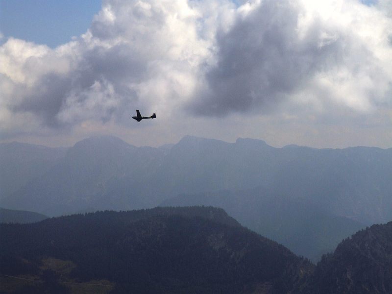
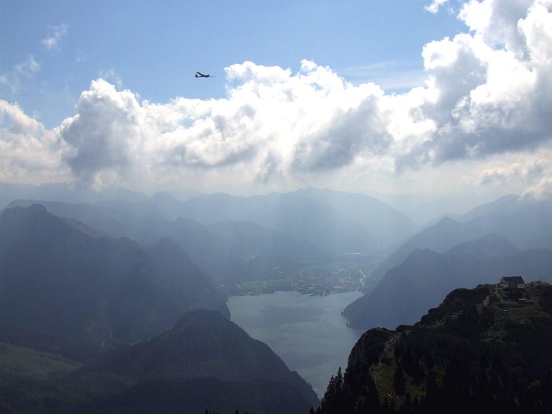
Nearly level with planes.
We now tackle the last 10 minutes to the summit. Still mist hanging in the northwestern wall.
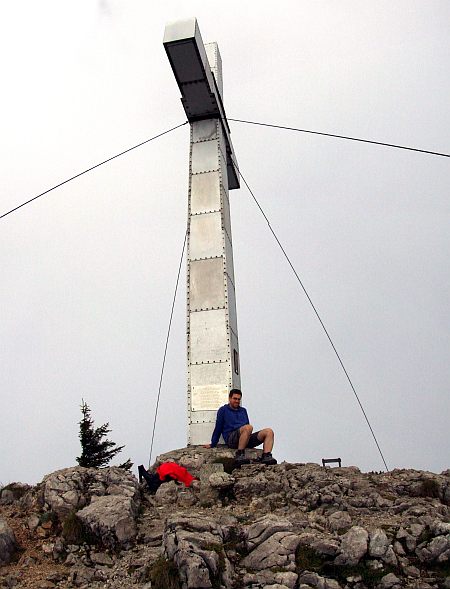
The summit cross of Traunstein at an altitude of 1.691 m.
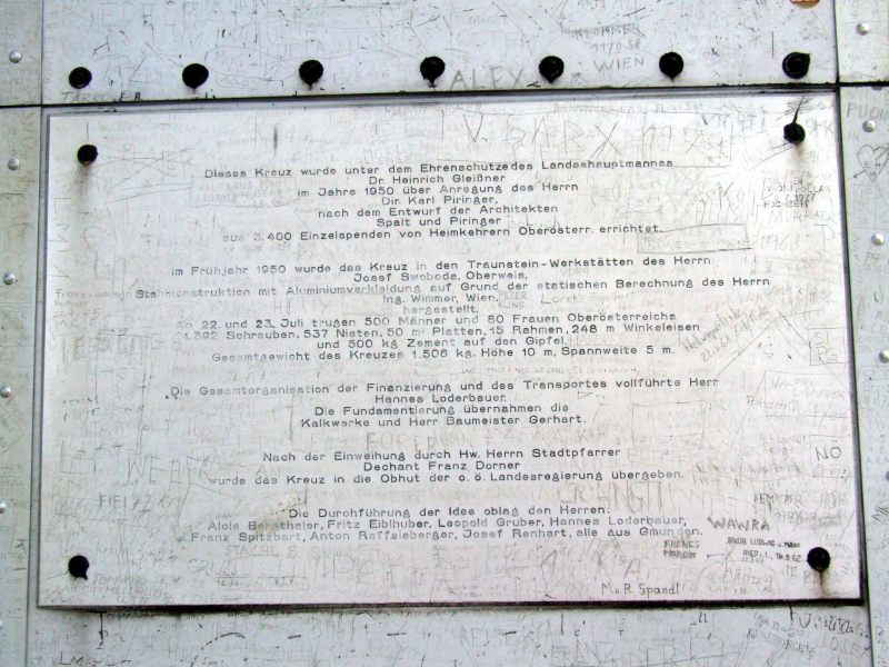
A plate about the history of the cross: In short it says, that the huge metal cross is 10 m high and 5 m wide, it weighs 1.506 kg. On July 22nd and 23rd, 1950, 500 men and 80 women carried 1.392 screws, 537 rivets, 50 m2 of plates, 15 frames, 248 angle steels and 500 kg cement to the summit. The material was financed by charity of 3.400 persons, mainly comprising men returning home from war.

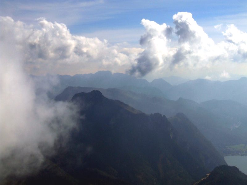
We now are sitting on the summit for nearly an hour and are fascinated by the fast drawing clouds around.
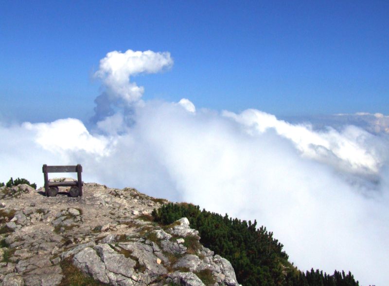
The bench near the cross.
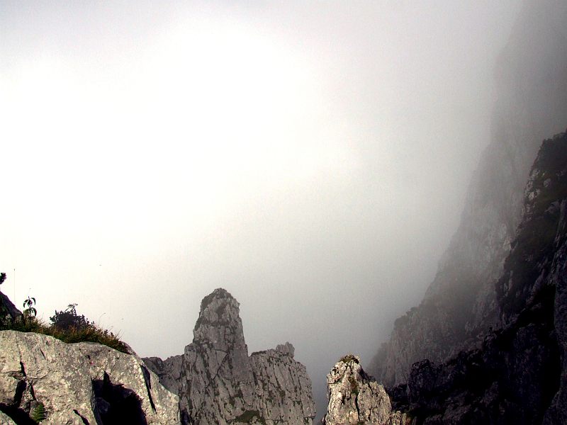
The visibility is not really excellent today.
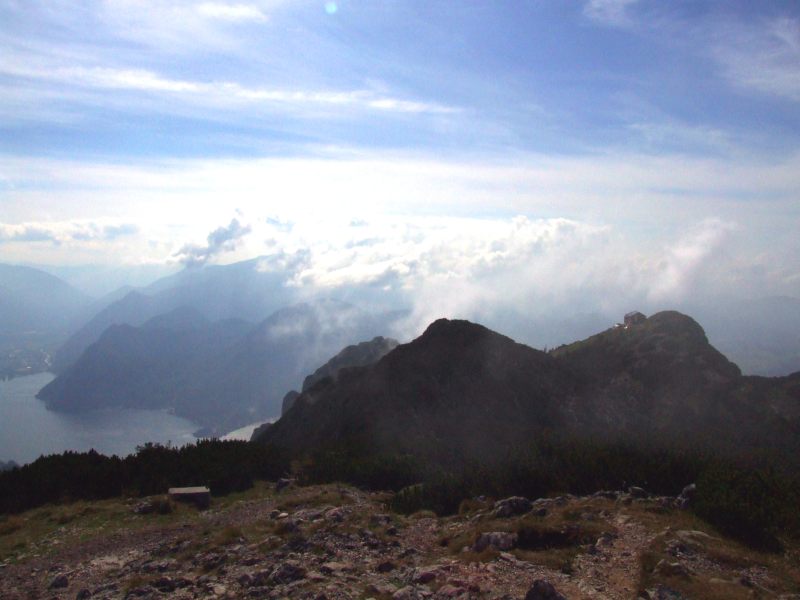
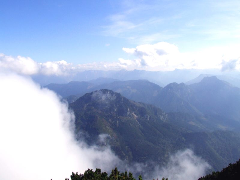
Mist on the ridge of Hoellengebirge.
Gmundnerhuette
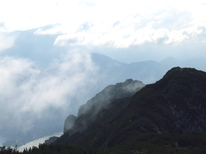
Traunsteinhaus
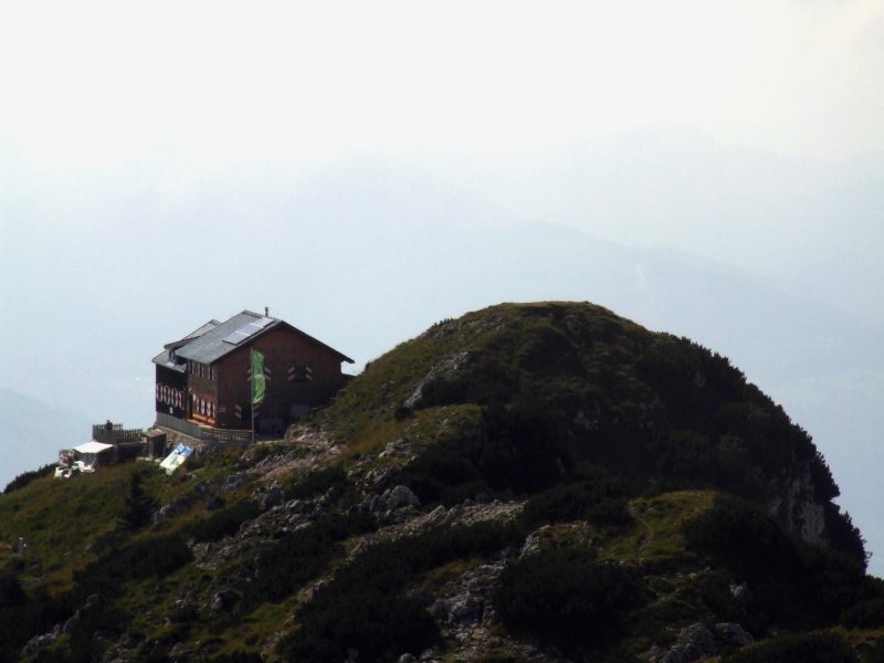
Gmundnerhuette
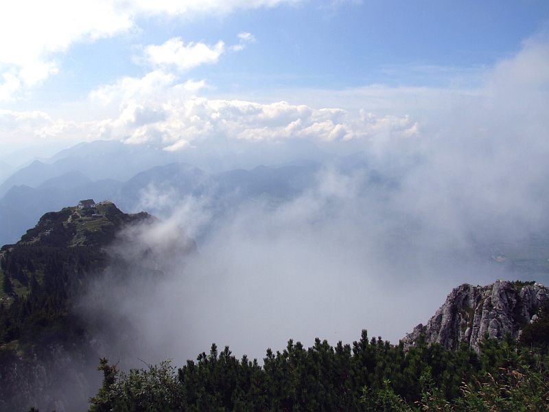
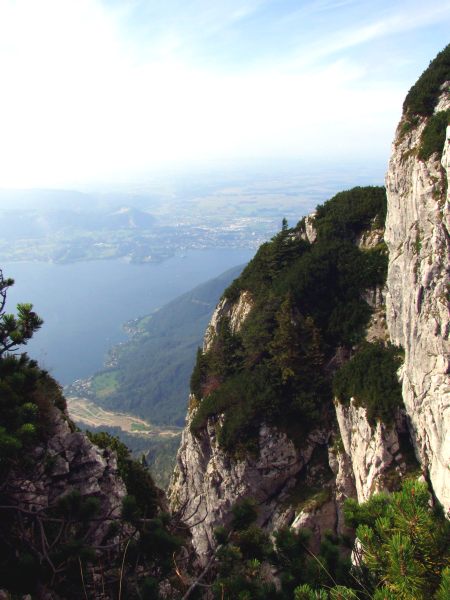
On the descent again: the mist is lifting now from the northwest wall ...
... to give way to the view to Altmuenster.
The uppermost part of the most difficult ferrata is leading through the wall far right., ...
... on which Gmundnerhuette is situated.
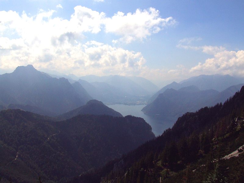
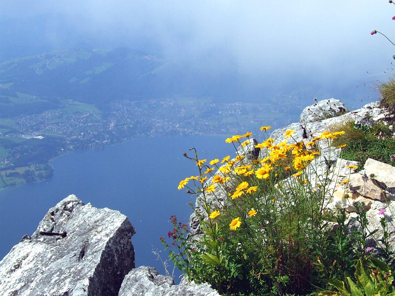
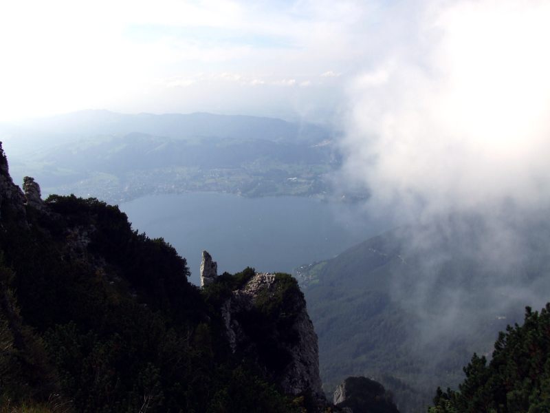
We make a short detour to Traunsteinhaus, to watch the stunning view down to all of the lake Traunsee. Click here or inside the picture for a larger version.
Traunsteinhaus
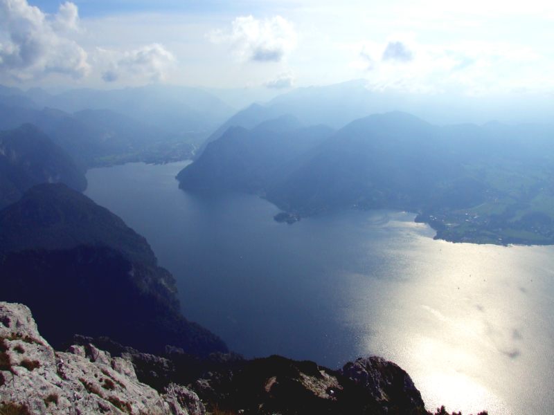
The southern part of Traunsee.
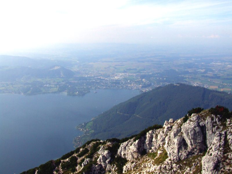
The northern part of Traunsees with the town of Gmunden.
Ssidiary building of Traunsteinhaus viewing to Gmundnerhuette and Traunstein summit.
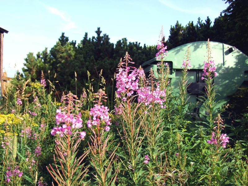
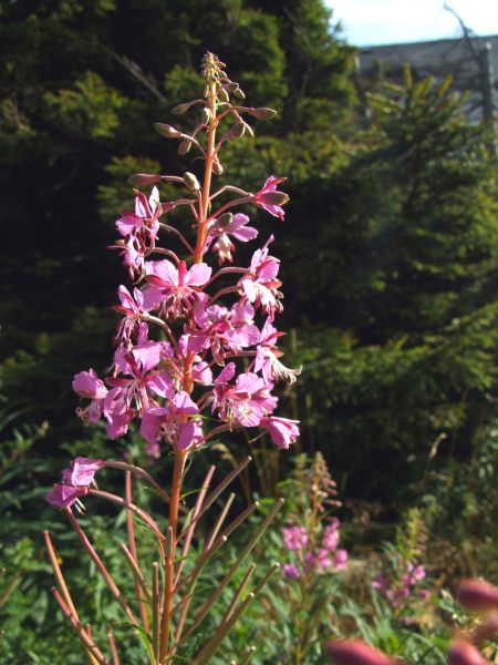
Rosebay willowherb (Epilobium angustifolium)
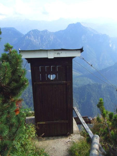
Sh... with a view (it is in use by the smell of it ...)
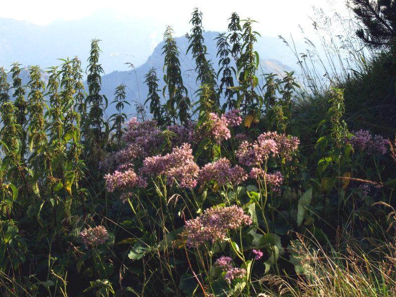
Kalk - Alpendost (Adenostyles Alpina)
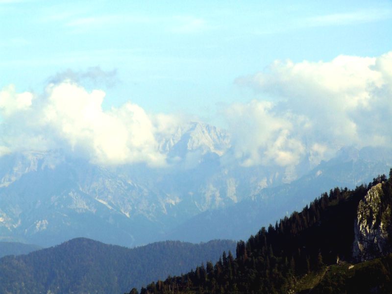
At least some view to Totes Gebirge, I suppose this is Grosser Priel (2.515 m)
Down the Mairalm path.
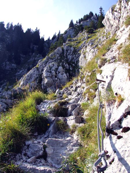
The path has perfect steps cut out of the rock, the rope is just for the anxious and the lazy ones (like me - you do much easyier down using the rope as an aid, I have to say!)
I cannot identify this plant at the moment.
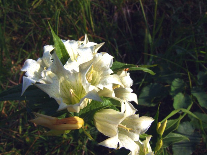
A rare albino variant of willow gentian (Gentiana asclepiadea)
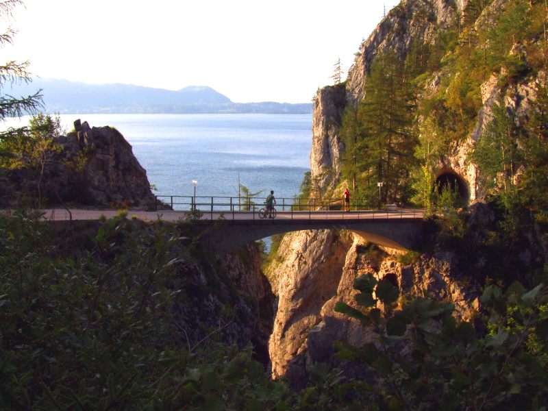
Once more at the bridge over Lainau beck ...
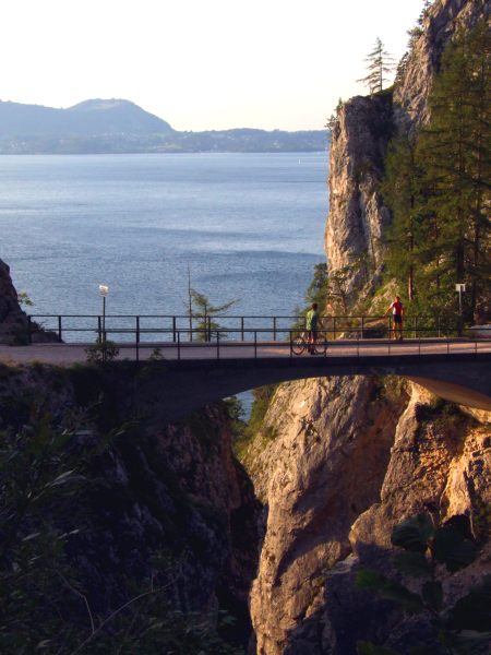
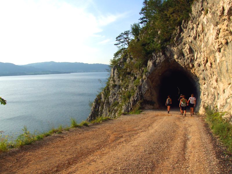
... and the tunnel nearby.
Back down at Traunsee.
Traunstein and Traunsee. I have stitched this picture from 10 photographs (in 3 rows)
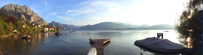
Panoramic picture of Traunsees viewing south, Traunstein far left. Click here ot into the picture for a larger version.
Hoellengebirge is free of couds now.
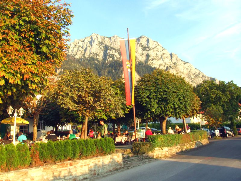
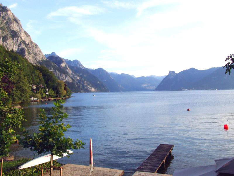
We have put the bicycles into the car, put off the boots and are now going for a good dinner in the Ramsau in, directly on the shore, where we watch the sun ...
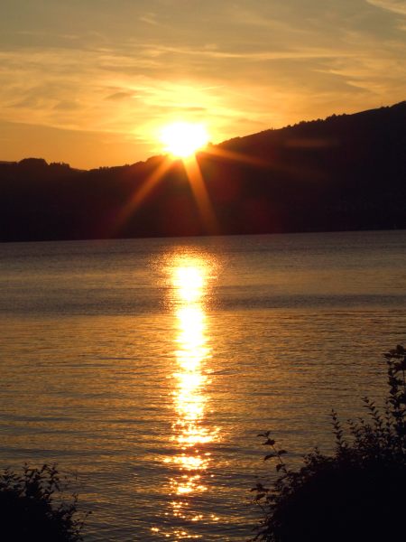
... disappearing behind the hills on the other side of the lake ...
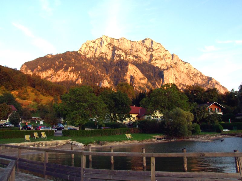
Traunstein however ...
... still recieves some sunlight.
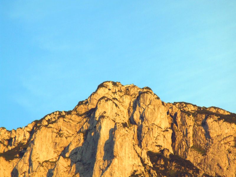
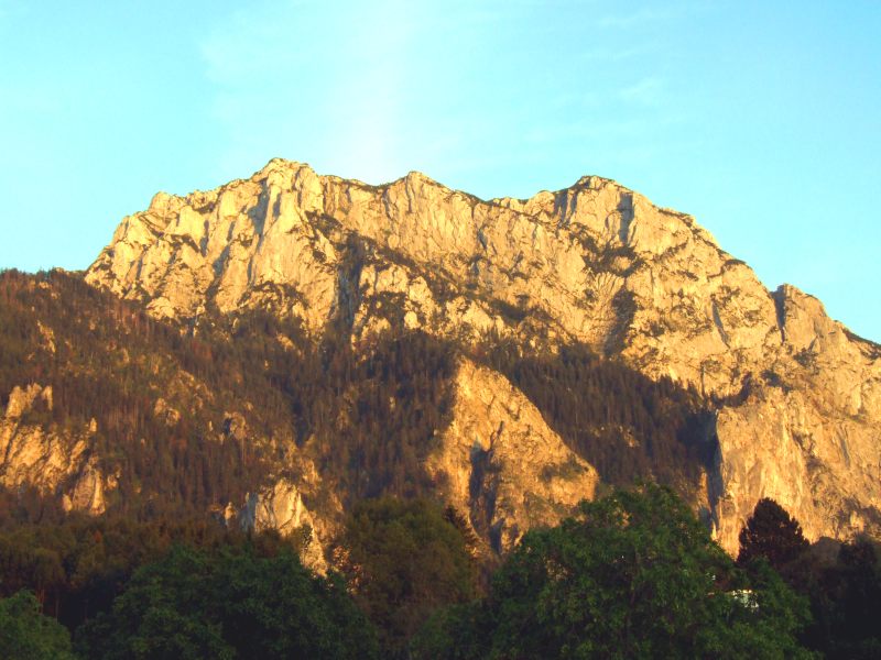
The summit region of Traunstein with Gmundnerhuette.
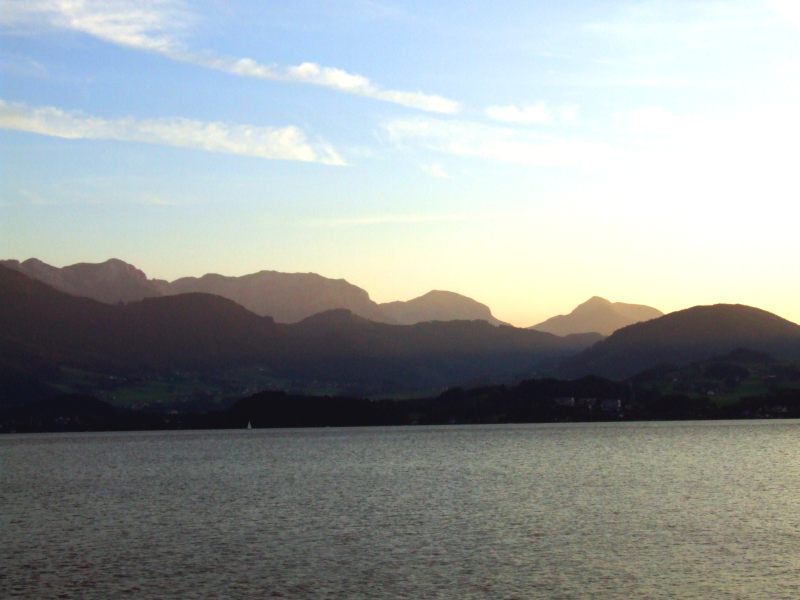
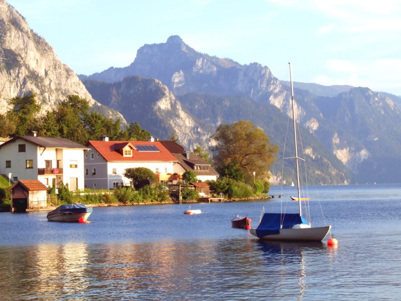
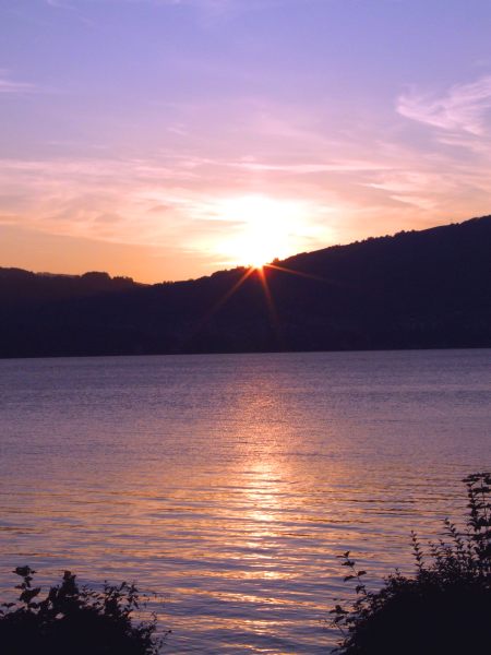
Evening on Traunsee with Hoellengebirge in the background.